Spotlight on North Platte
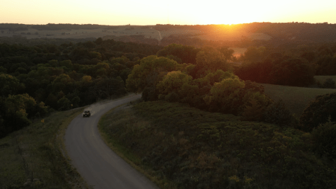
North Platte is one of many Nebraska towns that have an important connection to our country’s transcontinental transportation history. In honor of the 100th anniversary of the Lincoln Highway, Muriel Clark, assistant director of the North Platte/Lincoln County Visitors Bureau, shares her favorite stretch—from Gothenburg to North Platte—which allows travelers to rediscover the highway’s rich history. Zipping along Interstate 80 at 75 miles per hour, it is easy to overlook the accomplishments of the early Nebraska road-building pioneers. There are heroic tales of the westward migration, from the Oregon and California Trails and the Gandy Dancers who built the Union Pacific railroads. But the Lincoln Highway, what is now Highway 30 through most of Nebraska, was America’s first transcontinental highway. It just seems to slip into place fully formed. Envisioned in 1913 to be a hard-surface road running from New York’s Time Square to San Francisco’s Golden Gate Park, the Lincoln Highway began by utilizing local farm-to-market roads. While these were the best of the best for their day, the reality was in dry conditions they were dusty and nearly solid washboards. When the roads were wet, they were a morass of mud cut by deep ruts. These local roads followed property boundaries, creating a trademark “stair-step” pattern in the original 1913 Lincoln Highway alignment, which can be seen more clearly in the photo below. [caption id="attachment_848" align="aligncenter" width="614"] Aerial map showing the stairstep of the Lincoln Highway in Lincoln County.[/caption] By following the original alignment of the Lincoln Highway from Gothenburg to North Platte, modern-day travelers can experience the “stair-step” but with the added convenience of asphalt. In Gothenburg you can see the landmark “berm” where the original route heads toward a crossing of the North Platte River on the east end across from Highway 47. From there you can head west on County Road 764 (which becomes Banner Road), where it crosses into Lincoln County. Following the route all the way to Highway 83 south of North Platte, you’ll make no less than 24 90-degree (or nearly so) turns. Thanks to the magic of Google Maps on the Lincoln Highway Association website, if you take a wrong turn, you can still easily find your way back. Along the route you’ll pass many historical landmarks, including numerous Oregon Trail and Pony Express monuments, several pioneer cemeteries, and Fort McPherson National Cemetery. Established in 1863, the fort protected pioneers along the Oregon and Mormon trails as well as the construction workers on the Union Pacific railroad. It was decommissioned in 1880 and Nebraska’s only national cemetery was established. Remains from other decommissioned frontier forts were reinterred here and the graves of many notable historic figures can be found. It is open from dawn until dusk every day. The Lincoln Highway underwent numerous realignments through the years, moving to the north side of the Platte River when the bridge east of North Platte was completed in the 1920s. In North Platte, you can find some of the iconic concrete Lincoln Highway markers placed by the Boy Scouts in 1928 in Memorial Park on East 4th Street and at the historic 1913 Federal Building on the corner of 5th and Jeffers. On the west edge of North Platte, take a turn north on Buffalo Bill Avenue from Highway 30. Here you’ll find the Lincoln County Historical Museum, and just around the corner, the Buffalo Bill State Historical Park. The Lincoln County Historical Museum preserves the most heart-warming story in North Platte history. From Christmas day in 1941 through April 1, 1946, local volunteers met each and every U.S. military troop train traveling through on the Union Pacific railroad. By the time World War II ended, more than 6 million service personnel had been greeted with hometown hospitality. The original 1913 Lincoln Highway followed what are now Buffalo Bill Avenue and Scouts Rest Ranch Road, which reenters Highway 30 about a half-mile west of the ranch. Buffalo Bill called North Platte home for more than 40 years, and its where he founded his traveling Wild West and Congress of Rough Riders of the World attraction in 1882. He hoped one day to retire in North Platte but fortune didn’t favor him and he sold his 4,000-acre ranch in the early 1900s. Today the Nebraska Game and Parks Commission has preserved 250 acres of Scout’s Rest Ranch, including its historic mansion, horse barn and log cabin. It would take until 1935 before the dream of a hard-surfaced transcontinental highway was realized, and the final 6-mile stretch running from North Platte to Hershey was paved. To celebrate this achievement a gala was held on Nov. 5, 1935, approximately at the point where Scouts Rest Ranch Road reenters Highway 30. As you explore this small stretch of the Lincoln Highway, you’ll experience not only the history of the nation’s first coast-to-coast route, but also the history of its entire westward expansion.